Unmanned Missions
INSPECTION, MAPPING & SURVEYING
Precision Data. Reduced Risk. Real-World Performance.
Critical infrastructure, terrain intelligence, and environmental analysis all depend on accurate, repeatable aerial data. Whether inspecting assets up close or surveying broad geographic areas, operators require stable flight, consistent sensor alignment, and dependable performance in real-world conditions.
Robinson Unmanned UAS deliver aviation-grade stability, modular sensor integration, and gas-powered long-range endurance to support precise data acquisition — from close-range inspection to large-area mapping — without increasing human exposure.
CAPTURE WITH CONFIDENCE.
Every effective inspection or survey mission begins with stable, predictable flight.
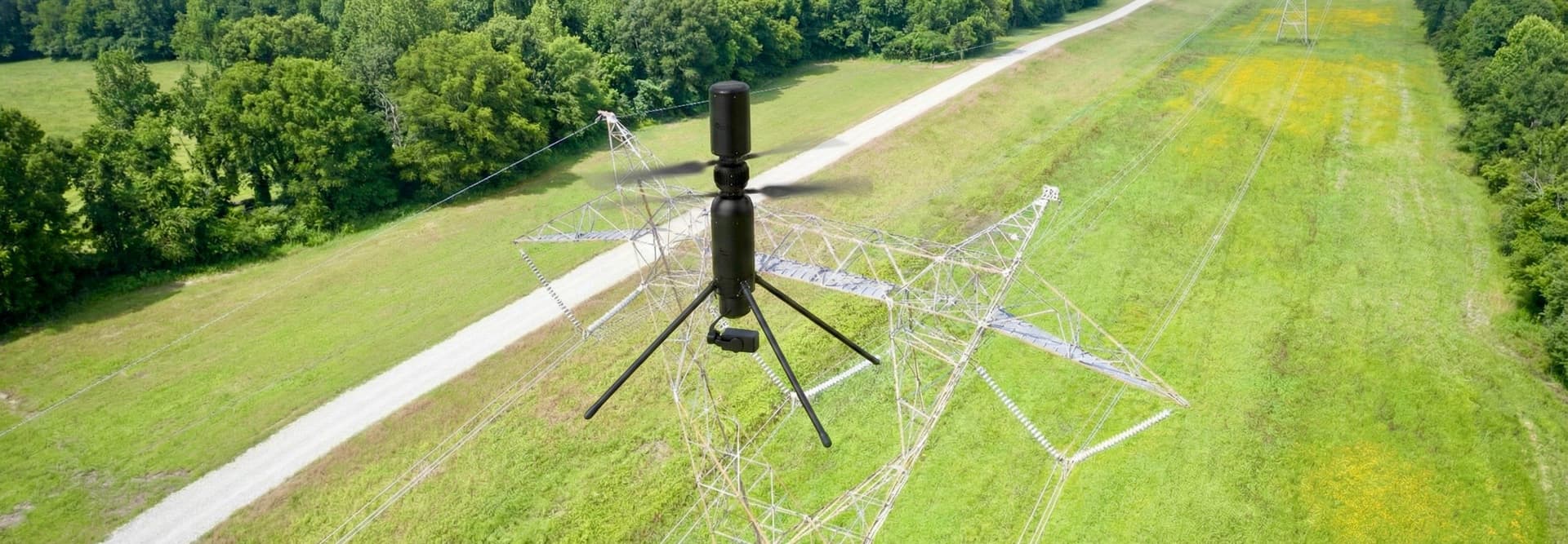
Compact UAS platforms such as SPIRIT and SPARTAN provide precision hover performance and repeatable waypoint navigation, supporting short- and mid-range missions with:
- Stable hover and controlled flight
- High-resolution visual and thermal imaging
- Multispectral and LiDAR payload capability
- Close-range structural inspection
- Linear infrastructure assessment
Learn more about the SPARTAN for high-performance, long endurance, precision data collection
SCALE COVERAGE WITHOUT COMPROMISE IN ANY CONDITION.
As mission scope expands from individual assets to corridors, facilities, or large geographic regions, endurance and payload flexibility become essential.
Larger unmanned platforms such as the R44 AIRTRUCK can extend flight duration and support expanded sensor suites, enabling broader coverage while maintaining precise flight control. Terrain-following capability and autonomy-supported navigation allow operations across varied landscapes, offshore environments, and industrial sites.
Whether documenting a single structure or surveying thousands of acres, consistency in flight performance drives consistency in data quality. No matter the weather. Robinson Unmanned platforms are purpose-designed to perform in environments that would ground other aircraft—manned or unmanned—delivering:
- Wind and weather resilience
- Stable positioning in complex terrain
- Repeatable autonomous flight paths
- Seamless integration with GIS, inspection, and asset-management systems
FROM DATA COLLECTION TO DECISION ADVANTAGE.
Unmanned systems transform high-risk inspection and large-area mapping into controlled, repeatable operations. Integrating unmanned aircraft into existing inspection and survey workflows enables operators to:
- Reduce human exposure to hazardous environments
- Increase operational frequency without increasing cost
- Improve documentation and regulatory compliance
- Shorten maintenance and planning cycles
- Accelerate time-to-insight for critical decisions
WHY ROBINSON UNMANNED
Robinson Unmanned platforms provide a dependable, aviation-grade solution for precision data acquisition across civil, industrial, environmental, and infrastructure missions.